Risk Management Strategies For Contractors Using Underground Locators
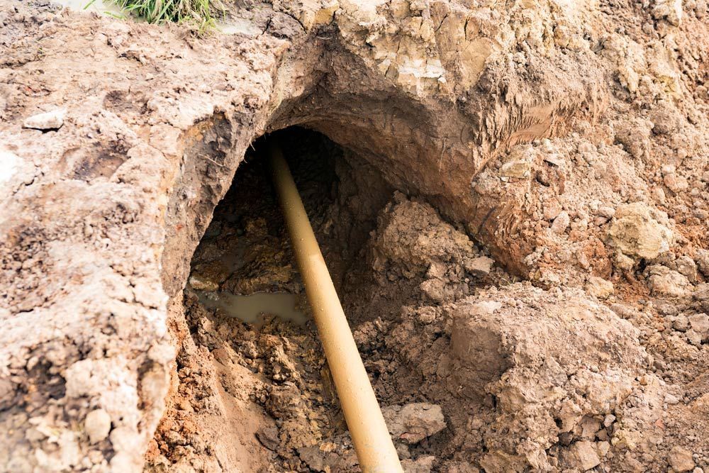
Excavation and drilling projects often begin with tight schedules, complex site constraints and pressure to avoid costly delays. Beneath the surface, however, lies a network of gas lines, electrical conduits, water mains and telecommunications assets that are not always accurately reflected in plans. A single misstep during digging or directional drilling can interrupt services, endanger crews and lead to significant project setbacks.
This is where underground locating becomes a critical part of the planning process. For contractors working across civil, commercial and infrastructure projects, the use of an underground service locator in Darwin supports safer decision-making before ground is broken. It helps identify buried utilities, reduce uncertainty and build a clearer picture of what is below the surface.
Effective risk management in this space is not just about compliance. It is about combining technology, training and process discipline to prevent avoidable incidents and keep projects moving with confidence.
Understanding Underground Service Locators in High-Risk Excavation Environments
Underground service locating involves the use of specialised detection tools and techniques to identify and map subsurface utilities before excavation or drilling begins. These services are essential in environments where infrastructure is dense or records are incomplete.
For contractors involved in directional drilling or trenching, locating services provide the first layer of risk control. They reduce guesswork and support safer excavation planning.
Key functions of underground service locating include:
- Identifying electrical, gas, water and communication assets
- Mapping approximate depths and alignments of utilities
- Reducing the likelihood of utility strikes during excavation
- Supporting compliance with safety and infrastructure regulations
- Assisting with planning for directional drilling paths and entry points
By establishing what lies beneath the surface early, contractors can better control risks and make informed decisions before machinery is deployed.
The Role of Pre-Excavation Planning in Risk Reduction
Strong pre-excavation planning sets the foundation for safer and more efficient project delivery. Before any ground disturbance begins, contractors must consider not only the scope of work but also the potential underground conflicts that may exist.
Pre-excavation planning supported by locating services allows teams to:
- Review existing utility records and site drawings
- Conduct on-site detection surveys for real-time verification
- Identify exclusion zones around high-risk utilities
- Plan excavation or drilling paths with reduced conflict risk
- Coordinate with utility providers where required
For directional drilling projects, this stage is particularly important. The bore path must be carefully designed to avoid crossing or compromising existing services. Without accurate locating input, even well-planned projects can face unexpected interruptions once drilling begins.
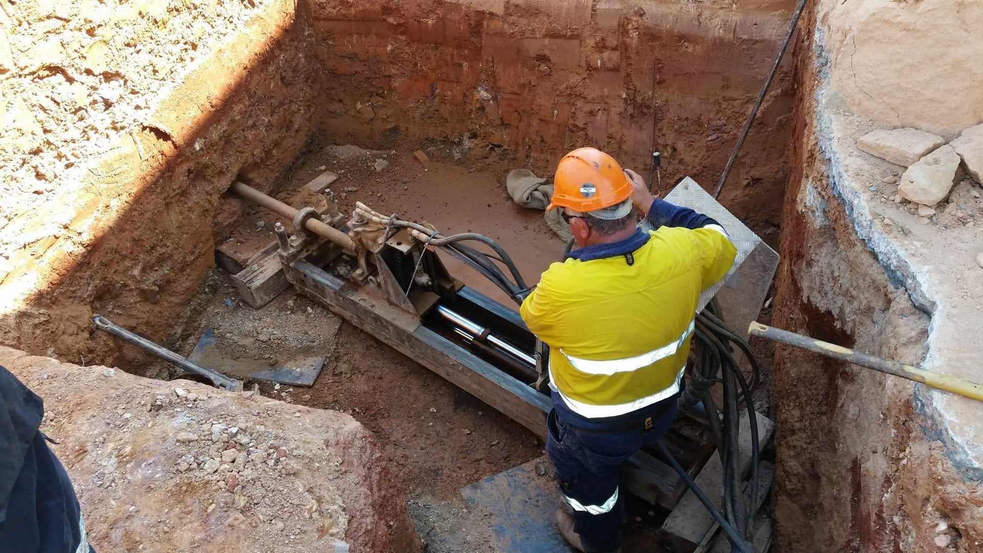
Why Accurate Utility Mapping Matters for Directional Drilling Projects
Directional drilling relies on precision. Unlike open excavation, where utilities may be visually exposed, drilling operates below ground with limited direct visibility. This makes accurate utility mapping essential.
When mapping is incomplete or outdated, contractors face increased uncertainty in bore alignment and depth control. Underground locating services help reduce this uncertainty by providing clearer subsurface intelligence.
Accurate mapping contributes to:
- Safer bore path design with fewer utility conflicts
- Reduced risk of service strikes during drilling
- Improved confidence in depth and alignment control
- Fewer delays caused by unexpected obstructions
- Better coordination between design and field teams
In practice, this means drilling crews can operate with a more reliable understanding of underground conditions. It also helps reduce reactive decision-making on site, which is often where risk levels increase.
Equipment Calibration and Detection Accuracy on Site
The effectiveness of underground locating depends heavily on the accuracy of the equipment being used and how well it is calibrated for site conditions. Soil composition, moisture levels and surrounding infrastructure can all influence signal clarity.
To maintain reliable detection outcomes, locating teams typically focus on:
- Regular calibration of electromagnetic and GPR equipment
- Cross-verification of multiple detection methods
- Adjustments for soil conditions and signal interference
- Ongoing equipment maintenance and testing protocols
- Site-specific scanning techniques based on utility density
For contractors, understanding these limitations is important. No single detection method is infallible, which is why combining technologies and interpreting results carefully is a key part of managing risk.
Reliable equipment use ensures that locating results are not just available but also meaningful for decision-making during excavation and drilling preparation.
Training Site Teams to Interpret Locating Data Correctly
Even with accurate detection tools, the value of underground locating depends on how well site teams interpret and apply the data. Misinterpretation can lead to incorrect assumptions about depth, alignment or service type.
Training plays a central role in bridging this gap between detection and execution.
Effective training programs for site teams often include:
- Understanding locating symbols and utility mapping outputs
- Interpreting depth indicators and signal variations
- Recognising limitations of detection accuracy
- Responding appropriately to conflicting data sets
- Applying locating results to excavation and drilling plans
For directional drilling crews, this knowledge directly impacts how bore paths are adjusted in real time. When teams are confident in reading locating data, they are better equipped to make safe adjustments without compromising project timelines.
Managing On-Site Hazards and Unexpected Utility Conflicts
Even with thorough planning and locating, unexpected conditions can still arise during excavation or drilling. Unknown or undocumented services, shifting ground conditions and legacy infrastructure all present ongoing risks.
Managing these hazards requires a structured response approach that includes:
- Immediate pause and reassessment when unexpected utilities are identified
- Re-verification using additional locating methods
- Clear communication between operators, supervisors and locating teams
- Adjustments to excavation or drilling plans based on new findings
- Documentation of all changes for compliance and future reference
In directional drilling environments, these adjustments are often made in real time. Having clear protocols in place ensures that safety is maintained without unnecessary disruption to workflow.
Documentation, Compliance and Project Accountability
Accurate documentation is a key component of risk management in underground works. It provides a record of what was identified, how decisions were made and what adjustments occurred during the project lifecycle.
Good documentation practices include:
- Recording locating results before excavation begins
- Logging any changes made to bore paths or excavation plans
- Maintaining communication records between stakeholders
- Storing as-built information for future reference
- Ensuring compliance with relevant safety standards and regulations
This level of accountability supports not only immediate project safety but also long-term infrastructure management. It also assists contractors in demonstrating due diligence if questions arise after project completion.
Integrating Underground Locating Services into Project Workflow
Underground locating is most effective when it is integrated into the overall project workflow rather than treated as a standalone step. When included early and consistently, it becomes a core part of risk management strategy rather than a last-minute requirement.
Integration typically involves:
- Scheduling locating services during initial site assessment
- Aligning detection outputs with engineering and design plans
- Incorporating locating data into excavation or drilling sequences
- Updating plans as new information becomes available
- Ensuring ongoing coordination between field and planning teams
For directional drilling projects in particular, this integration supports smoother execution and reduces the likelihood of rework caused by unforeseen underground conditions.
Book Reliable Underground Service Locating for Your Site
We at Austar Underground Services Pty Ltd understand the importance of reliable underground locating when it comes to managing risk in excavation and directional drilling projects. As an underground service locator in Darwin, our focus is on supporting contractors, engineers and project teams with accurate locating services that help reduce uncertainty before ground is disturbed.
If you are planning works in Darwin and need support with underground utility identification or directional drilling preparation, we are here to assist. Get in touch with our team to arrange a service or discuss your project requirements so you can move forward with greater confidence and clarity on site.